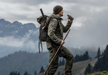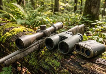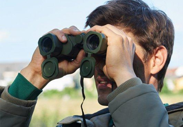










Laser Rangefinder for Forestry Survey and Tree Measurement
Forestry professionals often need to collect measurement information in complex outdoor environments.
Forests may contain tall trees, dense vegetation, uneven terrain and difficult observation conditions.
A laser rangefinder for forestry survey can provide a practical non-contact solution for measuring suitable targets from a distance.
Depending on the model, a professional forestry laser rangefinder may support:
Distance measurement
Tree height measurement
Angle measurement
Horizontal distance measurement
Vertical distance measurement
Long-range target observation
These functions can support forest inventory, tree management, woodland surveys and other outdoor measurement applications.
What Is a Forestry Laser Rangefinder?
A forestry laser rangefinder is a portable optical measurement device designed for outdoor distance measurement.
Professional models may combine a laser ranging system with optical observation and electronic measurement functions.
Depending on the configuration, the device may be used to measure:
Distance to trees
Tree height
Target angle
Horizontal distance
Vertical distance
This makes laser measurement equipment useful for selected forestry and environmental applications.
Why Is Laser Measurement Useful in Forestry?
Forests can create difficult measurement conditions.
Common challenges include:
Tall trees
Dense vegetation
Uneven ground
Limited access
Long walking distances
Traditional measurement methods may require additional equipment or more time.
A portable laser rangefinder allows the operator to collect selected measurement information from a suitable observation position.
Tree Height Measurement
Tree height is an important measurement in many forestry applications.
It may be used during:
Forest inventory
Tree surveys
Forest management
Timber assessment
Environmental research
A laser rangefinder with suitable height measurement functions can support non-contact tree height measurement.
How to Measure Tree Height with a Laser Rangefinder
A typical measurement process may include:
Selecting a suitable observation position
Identifying the tree base
Identifying the tree top
Measuring the required reference points
Using the appropriate height measurement mode
The device uses distance and angle information to calculate the height of the selected target.
Users should follow the operating instructions for the specific product.
Two-Point Tree Height Measurement
Two-point height measurement generally uses:
Tree Base + Tree Top
The device collects measurement information from both reference points.
This method may be useful when:
The tree base is visible
The tree top is clearly visible
The observation position is suitable
Three-Point Tree Height Measurement
Three-point measurement uses additional reference information.
This can be useful in more complex environments.
Potential situations include:
Uneven terrain
Hillside forestry
Elevated observation positions
Difficult tree locations
The specific procedure depends on the rangefinder design.
Laser Rangefinder for Forest Inventory
Forest inventory may involve collecting information about trees and forest resources.
Depending on the project, measurements may include:
Tree height
Tree position
Distance between trees
Terrain reference information
A laser rangefinder can provide distance and height data as part of a broader forestry survey workflow.
Measuring Tall Trees from a Distance
Some trees may be difficult to approach directly.
Dense vegetation or uneven ground can make access more difficult.
A laser rangefinder can allow the user to measure suitable tree targets from a distance.
Optical magnification can also help identify:
Tree tops
Branch structures
Reference points
Distant trees
Forestry Measurement on Uneven Terrain
Forests are often located in:
Mountains
Hills
Slopes
Valleys
The operator and tree may not be located at the same elevation.
Angle measurement can provide additional information about the relative position of the observation point and target.
This can support height-related calculations.
Measuring Distance Between Trees
Distance measurement can support selected forestry applications.
Users may measure:
Distance to individual trees
Distance between observation points
Distance to forest boundaries
Distance to selected targets
Laser measurement can provide a portable alternative for collecting distance information.
Optical Magnification for Forestry Applications
At longer distances, target visibility becomes important.
Optical magnification can help users:
Locate tree tops
Identify distant trees
Select suitable measurement points
Aim at specific targets
The appropriate magnification depends on the expected working distance and field conditions.
Field of View
Field of view affects target acquisition.
A wider field of view can help users locate trees more easily.
Higher magnification can provide additional target detail.
For forestry applications, buyers should evaluate:
Magnification + Field of View + Optical Clarity
together.
Long Range Laser Measurement in Forests
Long-range capability can be useful when trees cannot be approached easily.
However, actual measurement performance can depend on:
Tree size
Tree bark
Leaves
Branches
Target visibility
Weather conditions
Testing with representative forestry targets is recommended.
Target Characteristics
Trees are natural targets with irregular surfaces.
Measurement performance may vary depending on:
Tree size
Bark texture
Leaf coverage
Branch density
Target angle
Users should select clear and suitable measurement points whenever possible.
Weather Conditions
Forestry work often takes place outdoors in changing weather.
Potential conditions include:
Rain
Fog
Humidity
Bright sunlight
Dust
These factors may affect optical visibility and laser measurement performance.
Waterproof Forestry Laser Rangefinder
Outdoor forestry equipment may be exposed to moisture.
Useful features may include:
Waterproof protection
Dust resistance
Durable housing
Suitable operating temperature
The required protection level should match the working environment.
Portable Forestry Survey Equipment
Forestry professionals may carry equipment for long distances.
Portability is therefore important.
Buyers may consider:
Product weight
Product size
Battery life
Carrying convenience
Ease of operation
A compact device can be useful for repeated field measurements.
Battery Life for Forestry Field Work
Forestry surveys may require extended outdoor operation.
Battery performance should therefore be considered.
Important factors include:
Operating time
Charging method
Battery replacement
Power-saving functions
Reliable battery performance can support longer field sessions.
How to Choose a Forestry Laser Rangefinder
Before purchasing, consider the following factors.
Measurement Range
Select a range suitable for normal forestry working distances.
Height Measurement
Confirm whether the product supports tree height measurement.
Angle Measurement
Evaluate whether angle measurement is required.
Optical Performance
Check magnification and target visibility.
Environmental Protection
Consider waterproof and dust-resistant performance.
Portability
Evaluate product weight and carrying convenience.
Battery Performance
Check expected operating time.
How to Test a Forestry Laser Rangefinder
Professional buyers should test equipment under realistic conditions.
Tree Distance Test
Measure trees at different distances.
Tree Height Test
Measure trees with known reference information.
Slope Test
Test the product on uneven terrain.
Repeatability Test
Measure the same tree multiple times.
Optical Test
Evaluate tree top visibility.
Outdoor Test
Test the device under representative weather conditions.
Questions to Ask a Forestry Rangefinder Manufacturer
Before purchasing, buyers can ask:
What measurement range is available?
Does the product support tree height measurement?
Is angle measurement available?
What optical magnification is provided?
Is the device waterproof?
What is the operating temperature?
How long can the battery operate?
Can samples be supplied?
Is OEM service available?
Is ODM development available?
OEM Forestry Laser Rangefinder
OEM services can help distributors develop their own branded forestry measurement products.
Possible customization may include:
Brand logo
Product labels
Packaging
User manuals
Accessories
This can help distributors build a dedicated forestry equipment product line.
ODM Forestry Measurement Equipment
ODM services may be suitable for customers with specialized forestry applications.
Possible customization may include:
Measurement functions
Optical configuration
Product housing
User interface
Accessories
Packaging
Detailed requirements should be discussed with the manufacturer.
Frequently Asked Questions
What is a forestry laser rangefinder?
A forestry laser rangefinder is a portable laser measurement device that can support distance and, depending on the model, tree height and angle measurement.
Can a laser rangefinder measure tree height?
A suitable model with height measurement functionality can support tree height measurement.
How do you measure a tall tree without climbing?
A laser rangefinder can provide a non-contact measurement method from a suitable observation position.
Can a forestry laser rangefinder work on slopes?
A model with angle measurement can provide useful information for measurement on uneven terrain.
Does weather affect forestry laser measurement?
Rain, fog and other environmental conditions may affect target visibility and laser performance.
Is optical magnification important?
Yes. Optical magnification can help users identify distant tree tops and measurement points.
Can forestry laser rangefinders be customized?
Depending on the manufacturer, OEM and ODM customization may be available.
Conclusion
A forestry laser rangefinder can support distance and height measurement in complex outdoor environments.
By combining:
Laser Distance Measurement + Angle Measurement + Height Calculation + Optical Observation
professional users can collect useful measurement information for tree surveys and forest applications.
When selecting equipment, buyers should consider:
Measurement Range + Accuracy + Height Measurement + Optical Performance + Environmental Protection + Portability
For distributors and professional buyers, testing equipment with real trees and representative forestry environments is recommended before bulk purchasing.