









Long-Range Laser Rangefinder for Wildlife Observation and Conservation Research
Wildlife observation and conservation research often require researchers to study animals and their habitats without disturbing the surrounding environment. In forests, grasslands, wetlands, mountains, and protected natural areas, understanding distances between observation points and visible landscape features can support field documentation and research planning.
A long-range laser rangefinder for wildlife observation and conservation research provides a convenient way to measure distances to suitable visible targets without physically approaching them. Depending on the instrument's specifications and environmental conditions, it can support habitat surveys, wildlife observation, ecological fieldwork, and the documentation of natural landscapes.
Distance information can help researchers describe observation locations, estimate distances to selected terrain features, and organize field records. When used alongside binoculars, cameras, maps, and other research tools, a laser rangefinder can contribute to a more systematic approach to outdoor data collection.
This article explains how long-range laser rangefinders can support wildlife observation and conservation activities, what technical features matter in natural environments, and how researchers can use distance measurements responsibly.
What Is a Long-Range Laser Rangefinder?
A long-range laser rangefinder is an optical electronic instrument designed to measure the distance between the device and a suitable target. Many models calculate distance by analyzing the travel time of a laser signal reflected from the target.
The effective measuring distance depends on the instrument design, target size, target reflectivity, atmospheric conditions, visibility, and operator stability.
In wildlife research, the instrument may be used to measure distances to stationary landscape features, such as trees, rocks, observation markers, or other clearly identifiable targets. Some devices also provide optical magnification, angle measurement, or calculated horizontal distance.
These functions can help researchers obtain useful field measurements without making unnecessary physical contact with the target area.
However, a laser rangefinder does not automatically identify animal species, determine population size, or measure an animal's health. Such research objectives require appropriate observation methods and, where necessary, specialized scientific equipment.
Applications in Wildlife Observation
1. Measuring Distances to Landscape Features
Natural environments contain a variety of terrain features that may serve as useful reference points during field research.
Researchers may need to record the distance from an observation position to a tree line, rock formation, ridge, or other visible landmark. A long-range laser rangefinder can provide direct distance readings when the target is suitable and the line of sight is unobstructed.
These measurements can help describe observation conditions and improve the consistency of field notes.
For repeatable results, researchers should record the observation point, target description, measurement method, and relevant environmental conditions.
2. Supporting Birdwatching and Wildlife Observation
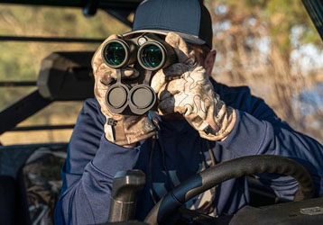
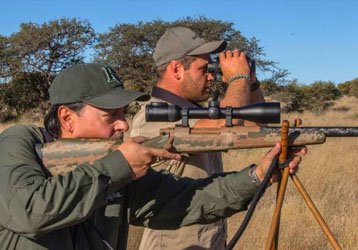
Wildlife observers often use binoculars or spotting scopes to examine distant animals without approaching them closely.
A laser rangefinder can complement these optical tools by providing distance information to suitable targets. Knowing the approximate distance to a fixed landmark near an observation area may help researchers describe where an observation took place.
However, measuring directly toward an animal may not always be appropriate. Laser use should follow applicable wildlife protection rules, instrument safety instructions, and research protocols. When possible, researchers should use stationary reference points rather than repeatedly directing a laser toward wildlife.
Distance measurements should also be interpreted carefully because the distance to a nearby landmark is not necessarily the distance to the animal being observed.
3. Supporting Habitat Assessment
Habitat assessment may involve recording the spatial relationships between vegetation, water sources, open ground, shelter areas, and other environmental features.
A rangefinder can assist with preliminary distance measurements between a field observer and selected visible habitat features. These readings may be useful for field notes and initial site descriptions.
For comprehensive habitat mapping, researchers may also need geographic information systems, GNSS receivers, remote sensing data, and established ecological survey methods.
A handheld rangefinder should be considered one part of the research toolkit rather than a complete habitat mapping solution.
4. Observing Wildlife in Open Grasslands
Grasslands and open plains can provide long sightlines, making them suitable environments for some types of distance measurement.
Researchers may use a rangefinder to measure the distance to visible trees, landscape boundaries, observation markers, or other stationary reference points. Such information can support descriptions of the observation area and help organize field records.
Actual measurement performance depends on visibility, target reflectivity, target dimensions, and atmospheric conditions. Heat shimmer, haze, and distant vegetation may make measurements less consistent.
5. Supporting Mountain and Forest Research
Mountainous and forested environments can introduce additional measurement challenges. Uneven terrain, dense vegetation, changing elevation, and limited sightlines may affect the selection of suitable targets.
A rangefinder can be useful when a clear line of sight is available. Devices with angle measurement functions may also support certain preliminary geometric calculations.
However, the straight-line distance to a target is not the same as the walking distance along a trail. Similarly, line-of-sight distance and horizontal distance can differ when the target is at a different elevation.
Researchers should identify the type of distance recorded and avoid treating these measurements as interchangeable.
How Rangefinders Support Conservation Fieldwork
Consistent Field Documentation
Conservation research often involves repeated observations across different locations or time periods.
A rangefinder can help researchers record distances to fixed reference points, making field notes more consistent. When the same location is revisited, using clearly identified reference points and a repeatable measurement procedure can improve comparability.
For studies requiring formal spatial accuracy, the research team should establish appropriate measurement protocols and use instruments that meet the project's requirements.
Observation Site Planning
Before conducting a survey, researchers may need to identify suitable observation positions with clear views of relevant habitat features.
Distance measurements can help describe these positions and support preliminary field planning. Combined with maps and geographic data, the measurements may help researchers organize observation routes and document the layout of a study area.
A rangefinder does not replace navigation equipment or a site safety assessment. Researchers should plan routes with consideration for terrain, weather, access permissions, and wildlife protection requirements.
Non-Contact Environmental Measurement
One advantage of laser rangefinding is that it can measure distance without requiring the operator to physically touch the target.
This may be useful when targets are located across a stream, on a steep slope, or in a sensitive habitat where unnecessary disturbance should be avoided.
Non-contact measurement does not mean that every laser application is harmless to wildlife. Researchers must follow the instrument's laser safety instructions and avoid inappropriate use around animals or people.
Important Features for Wildlife Observation
Selecting a suitable rangefinder requires understanding how its specifications relate to the research environment.
Measuring Range
The specified maximum measuring range indicates the distance at which the manufacturer states that the instrument can measure under defined conditions.
A large, reflective target in clear weather may be easier to measure than a small, dark target partially obscured by vegetation.
For wildlife observation, buyers should consider typical viewing distances, the size of the stationary reference targets, and the visibility conditions likely to occur in the field.
Optical Magnification
Optical magnification helps users observe distant landscape features and identify suitable measurement targets.
Magnification can be valuable in open environments, but higher magnification may also make hand movement more noticeable. Optical clarity, field of view, eye comfort, and device stability should be considered together.
A rangefinder with an appropriate optical system can make target identification easier, but magnification alone does not guarantee accurate distance measurement.
Accuracy and Repeatability
Accuracy describes how close a measurement is to the true value under specified conditions. Repeatability describes how consistently similar readings can be obtained when measurements are repeated under comparable conditions.
Both characteristics matter when distance information is included in research records.
For important measurements, researchers should follow a consistent procedure, use suitable targets, and verify results with an independent method when required.
Angle Measurement
Some rangefinders include angle sensors that may help users calculate horizontal distance or obtain additional geometric information.
This function can be useful in hilly or mountainous environments where the observer and target are at different elevations.
Researchers should confirm which values the instrument displays and whether the values are measured directly or calculated. For formal topographic work, a suitable surveying method may be necessary.
Battery Performance and Portability
Field researchers may spend extended periods away from charging facilities. A lightweight device with suitable battery performance can be convenient for repeated outdoor observations.
Consider the instrument's battery type, operating time, controls, display readability, carrying case, and ease of use with outdoor equipment.
Battery performance can vary with temperature and usage patterns, so manufacturer specifications should be reviewed before planning extended fieldwork.
Environmental Protection
Outdoor research can expose instruments to rain, humidity, dust, temperature fluctuations, and accidental impacts.
Review the device's stated environmental protection rating, operating temperature range, and storage recommendations. A water-resistance rating does not guarantee suitability for every weather condition.
For coastal wetlands, tropical forests, or other humid environments, environmental suitability and proper maintenance deserve particular attention.
Factors That Affect Measurement Performance in Natural Environments
Natural environments can be more challenging than controlled measurement settings.
Vegetation and obstructions: Branches, leaves, tall grass, and shrubs may block the laser's path or interfere with target selection.
Target reflectivity: Dark or low-reflectivity surfaces may return a weaker signal than large, bright surfaces.
Atmospheric visibility: Fog, rain, haze, and airborne particles can affect the reliability of long-distance measurements.
Target size: Small or narrow targets may be difficult to measure consistently at long distances.
Uneven terrain: Changes in elevation can affect the relationship between line-of-sight distance and horizontal distance.
Operator movement: Hand movement can make it harder to aim consistently, particularly when optical magnification is used.
Sunlight and background conditions: Strong sunlight and complex natural backgrounds may complicate target identification.
When readings are unstable, researchers should choose a more suitable stationary target, repeat the measurement under better conditions, and document any limitations that may affect interpretation.
Responsible Use Around Wildlife
Wildlife observation should prioritize animal welfare, habitat protection, and compliance with applicable rules.
A laser rangefinder should not be used in ways that unnecessarily disturb animals. Researchers should avoid repeatedly aiming a laser at wildlife, especially near the eyes, and should follow the instrument's safety instructions.
Where possible, measurements to fixed landscape reference points can provide useful spatial context without directing the laser toward an animal.
Researchers should also consider the sensitivity of the study location. Revealing precise locations of endangered species, nesting sites, or vulnerable wildlife populations may create conservation risks. Field data should be shared and stored according to the project's data-protection and conservation policies.
A rangefinder is a measurement tool, not a substitute for ethical research design or appropriate wildlife observation practices.
Long-Range Laser Rangefinder vs. Other Field Equipment
Different instruments contribute different types of information to conservation research.
A laser rangefinder provides distance measurements to suitable visible targets. Binoculars and spotting scopes support visual observation, while cameras provide photographic records. GNSS receivers can support positioning, and GIS software can help organize spatial data.
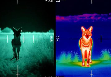
Thermal imaging equipment may help detect temperature differences in suitable applications, but its effectiveness depends on the device, target, environment, and observation objective.
For comprehensive ecological research, these tools may be used together. The correct combination depends on the research question, required accuracy, terrain, budget, and applicable wildlife regulations.
How to Choose a Rangefinder for Conservation Research
Before purchasing a long-range laser rangefinder, researchers and field teams should consider several questions:
What is the typical distance to the targets being measured?
Are the main targets large, stationary landscape features or small objects?
Will the device be used in forests, grasslands, mountains, wetlands, or coastal environments?
Is optical magnification important for identifying targets?
Are angle measurement or horizontal distance functions required?
What level of accuracy and repeatability does the study require?
Will the instrument be used in rain, humidity, dust, or low temperatures?
How long must the device operate away from charging facilities?
What laser safety information and operating documentation are available?
Are there specific research protocols or wildlife protection rules governing its use?
Answering these questions before purchase can help teams choose equipment that better matches their field conditions.
Frequently Asked Questions
What is a long-range laser rangefinder used for in wildlife observation?
It can measure distances to suitable visible targets, such as trees, rocks, observation markers, and other landscape features. These measurements may help researchers document observation locations and support preliminary field surveys.
Can a laser rangefinder measure the distance to a wild animal?
Some devices may obtain readings from animal targets under certain conditions, but direct measurement is not always appropriate or reliable. Researchers should follow wildlife protection protocols and avoid disturbing animals. A fixed reference point may be a better choice for many field documentation tasks.
Can a rangefinder be used for habitat mapping?
It can support selected distance measurements, but it does not automatically create a complete habitat map. Comprehensive mapping may require GNSS, GIS, remote sensing, or professional surveying methods.
Does a longer measuring range always mean better performance?
No. Effective performance also depends on target size, reflectivity, visibility, instrument stability, and environmental conditions. The best device is one that meets the actual research requirements.
Is a laser rangefinder suitable for mountainous research?
It can be useful when suitable targets are visible. However, researchers should distinguish between straight-line distance, horizontal distance, and travel distance along terrain. Devices with angle functions may support certain preliminary calculations.
How can researchers improve measurement consistency?
Use clearly identified stationary targets, maintain a stable observation position, repeat important readings, and record the measurement method and environmental conditions. Verify critical results using an appropriate independent method.
Conclusion
A long-range laser rangefinder can be a useful supporting tool for wildlife observation and conservation research. By measuring distances to suitable visible landscape features, it can help researchers document observation locations, organize field surveys, and collect more consistent distance information.
When selecting equipment, consider effective measuring range, target characteristics, optical performance, accuracy, repeatability, angle functions, battery performance, and environmental protection.
Responsible operation is equally important. Researchers should avoid unnecessary disturbance to wildlife, follow laser safety instructions, respect protected-area rules, and protect sensitive location data where necessary.
When combined with appropriate field protocols and complementary research tools, a long-range laser rangefinder can contribute to more organized and reliable ecological fieldwork.